The USA Leaders
July 29, 2025
Shriharikota – On July 30, 2025, an extraordinary milestone in space exploration is set to unfold. The NASA-ISRO NISAR mission, a collaboration between the United States’ NASA and India’s ISRO, will launch with a goal that will impact everything from climate change research to disaster response. This game-changing satellite will provide high-resolution data to track subtle surface changes across the globe. Here’s everything you need to know about this groundbreaking mission.
Mission Brief: What to Expect from the NASA-ISRO NISAR Satellite
The NASA-ISRO Synthetic Aperture Radar (NISAR) mission, set to launch on July 30, 2025, at 17:40 IST from the Satish Dhawan Space Centre in Sriharikota, India, is poised to revolutionize Earth observation. The satellite, weighing approximately 2392 kg, will be launched aboard an ISRO Geosynchronous Satellite Launch Vehicle (GSLV-F16) rocket into a sun-synchronous orbit at an altitude of 747 km.
Key technical features of the mission include:
- Orbit Inclination: 98.4°, ensuring optimal coverage of Earth’s surface across a wide range of latitudes.
- Time of Nodal Crossing: The satellite will cross the equator at approximately 6 AM/6 PM local time on each orbit, allowing for consistent observation conditions.
- Commissioning and Calibration: The first 90 days post-launch will be dedicated to commissioning the satellite and calibrating its instruments before full science operations begin.
This advanced mission will allow global Earth monitoring with dual-frequency radar instruments, setting the stage for valuable scientific data collection starting immediately after deployment.
Mission Objectives: Key Goals of the NISAR Mission for Earth and Climate
The NISAR mission aims to make significant contributions in the following areas:
- Monitoring Earth Surface Changes: NISAR will measure subtle shifts in Earth’s surface, including the movement of tectonic plates, ground deformation, and glacier retreat.
- Disaster Response and Risk Reduction: The satellite will help track natural disasters such as earthquakes, tsunamis, and volcanic eruptions, providing timely data for disaster management and humanitarian efforts.
- Environmental Monitoring: The mission will gather data on climate patterns, forest biomass, wetlands, groundwater, and vegetation changes, helping researchers better understand and combat climate change.
- Glacier and Ice Mass Surveillance: NISAR will also monitor the melting of glaciers and its contribution to rising sea levels, particularly in polar regions.
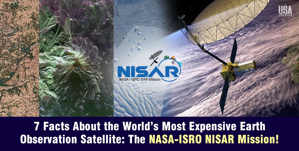
- Radar Imaging Capability: After launch, the satellite will deploy a 12-meter diameter mesh antenna, enabling it to capture high-resolution radar images of Earth’s surface, critical for all its observation tasks.
7 Must-Know Facts: Essential Insights into the NISAR Mission’s Impact
- Dual-Frequency Radar Technology: NISAR will be the first satellite to use both NASA’s L-band (24cm) and ISRO’s S-band (10cm) radar frequencies, allowing for precise monitoring of different surface types. The L-band is ideal for tracking deep forest biomass, while the S-band excels in monitoring agricultural and urban landscapes.
- Global Coverage Every 12 Days: The satellite will revisit any point on Earth every 12 days, ensuring timely and consistent data. This is particularly vital for monitoring dynamic events like earthquakes or wildfires.
- No Weather Barriers: Unlike optical satellites, NISAR can operate in all weather conditions, day or night. The radar can penetrate clouds, fog, and darkness, providing reliable data regardless of weather conditions.
- Advanced SweepSAR Technology: NISAR uses the SweepSAR technique, which allows for wide-area imaging (up to 240 km wide) while maintaining a high spatial resolution, up to 2 meters. This increases efficiency and allows for more data to be captured in a shorter amount of time.
- High Data Throughput with Open Access: NISAR is designed to generate massive volumes of data. The mission ensures that all data will be made publicly available to the global scientific community, aiding a variety of research efforts and applications.
- Precision in Orbit: The satellite will be placed into a sun-synchronous orbit, providing consistent lighting conditions for observations. This precision ensures repeatable measurements of the same areas, allowing for comparison over time.
- Collaborative Engineering: The mission is a result of the combined efforts of NASA and ISRO. NASA provides the L-band radar and key subsystems, while ISRO contributes the S-band radar, satellite bus, and launch services. This international collaboration showcases the strength of global teamwork in advancing space science.
Cost of the Most Expensive Earth Observation Satellite NASA-ISRO NISAR Mission!
The NASA-ISRO NISAR mission comes with a hefty price tag estimated at $1.5 billion (approximately ₹12,750 crore). This makes it the most expensive Earth observation satellite ever launched, covering everything from development to initial operations.
Cost Breakdown
- NASA’s Share: Around $1.1–1.2 billion, including the L-band synthetic aperture radar (SAR), the 12-meter deployable mesh antenna, telecommunication systems, and GPS receivers.
- ISRO’s Share: Close to ₹788 crore (about $93–94 million), covering the S-band radar, satellite bus, launch vehicle (GSLV Mk II), and launch operations.
The Global Impact and Future of the NASA-ISRO NISAR Mission
The NASA-ISRO NISAR mission is not just a technological marvel; it is a monumental step forward in global Earth observation. By providing data that will improve our understanding of everything from disaster management to climate change, NISAR will become an indispensable tool for researchers, governments, and environmental organizations worldwide.
With its launch scheduled for July 30, 2025, the world is about to witness a new era of space-based environmental monitoring that will shape the future of our planet’s preservation.
Also Read: Ray Dalio’s Alarm: Economic Heart Attack Warning for the US! Is the Economy Drowning?